It Might Just Save Your Life
Planning your self-guided trek
The Buller Huts Trail is a challenging grade 5 trek for experienced, self-reliant adventurers with a good level of fitness and an understanding of the risks of remote alpine hiking. Weather conditions can change rapidly, even in summer, and people have been caught unprepared in cold, wet, and blizzard conditions. This is not a trek for beginners, so please be prepared.
Plan Your Hike
Fitness and Experience
Essential gear
The following is a suggested gear list. You may need to adjust it based on your individual needs and the specific conditions of the trail. Download my free checklists to make sure you’ve considered everything.
Camping on the Buller Huts Trail
Backcountry huts are for emergencies only, so please resist the temptation to sleep in them. Please follow hut etiquette and fire safety codes to keep these important resources available for everyone.
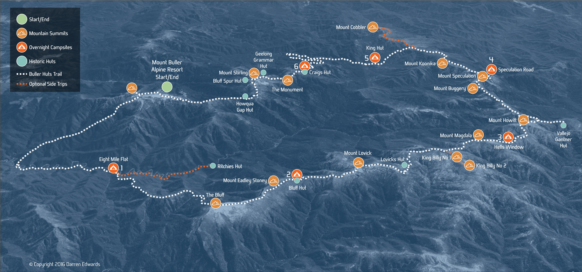
Dispersed camping is allowed throughout most of the Alpine National Park, so you can pitch your tent almost anywhere you like. There’s also a few designated campgrounds, but they can fill up quickly when the weather warms up. Some campgrounds, like Bluff and Craig’s Hut, have water tanks and toilets, but these are not guaranteed to be working, so it’s important to be self-reliant.
Check the weather conditions
Route Maps
Max elevation: 1775 m
Min elevation: 483 m
Total climbing: 5756 m
Main Route
The Buller Huts Trail (96km)
Download the full GPX file, including side trips and the King-Craigs shortcut.
My original GPX files have been simplified for use on this site, so they may not be accurate enough for navigation. I recommend purchasing the relevant topographic maps and using a map and compass to navigate in the field.

Side Trips
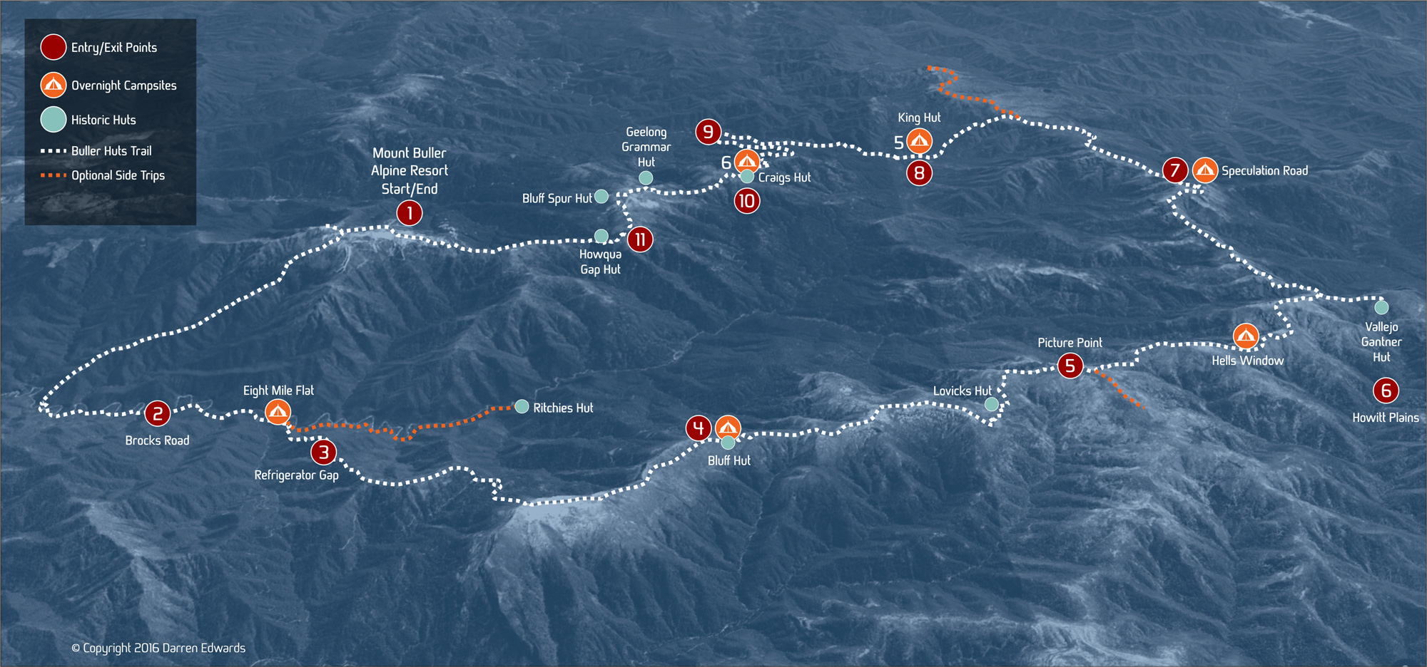
Access and Evacuation Points
Determining evacuation points when planning a hike is essential for safety. If you become lost, injured, or encounter bad weather, knowing where to go, what to do, and where to direct search and rescue crews, can be life-saving. Evacuation points can also help you avoid rash decisions in an emergency, and communicate your plans clearly to others. If you’re hiking with a group, let everyone know where the evacuation points are so everyone is on the same page in an emergency.
Note the recommended evacuation points below, these can also serve as trailheads, food, and gear drop locations.


